Wednesday, Feb 19, 2025 08:45 [IST]
Last Update: Tuesday, Feb 18, 2025 16:42 [IST]


GANGTOK, :The NAKSHA (National
Geospatial Knowledge-based Land Survey of Urban Habilitation) project of the
Department of Land Revenue and Disaster Management, Government of Sikkim, was
launched by Gangtok MLA and UDD advisor Delay Namgyal Barfungpa at Gangtok
Municipal Corporation Hall at Deorali here Tuesday.
Barfungpa expressed his
enthusiasm regarding the launch of NAKSHA, characterizing it as a crucial
initiative for the State of Sikkim.
NAKSHA presents an opportunity
for the residents of Sikkim to update their essential land records, as the State
continues to operate on outdated land survey documents that require thorough
review.
The MLA emphasized the
importance of accountability among officials in fulfilling their
responsibilities and encouraged collaboration among officials, councillors, and
the public.
He highlighted the necessity of
urban planning and advocated for enhanced urban development strategies,
incorporating water harvesting and solar technologies. He commended NAKSHA as a
vital step towards achieving progressive advancements and encouraged the public
to take an active part in realizing these objectives.
He concluded by reiterating the
vision for a ‘Sunaulo Samridha ani Samartha Sikkim’ through cooperative efforts
across all sectors, highlighting that accountability remains of paramount
importance.
Gangtok district collector
Tushar G. Nikhare informed that one of the most time-consuming tasks
encountered by officials in district offices is the resolution of land
disputes, particularly in urban areas where precision is critical and the
margin for error cannot exceed one centimeter.
He acknowledged the
implementation of NAKSHA under the Digital India Land Records Modernization
Program (DILRMP), which has pioneered the practice of maintaining digital records
of land holdings.
Nikhare highlighted the
necessity of reviewing land parchas to ensure they remain relevant in
contemporary times. He underscored the importance of having land records in the
public domain, facilitating accessibility from all corners of the globe, and
expressed optimism that NAKSHA could effectively bridge this gap.
The DC further pledged to work
on minimizing the disputes related to land resolution to prevent inconvenience
to the public. He also conveyed his commitment to ensuring that the public does
not face any inconvenience.
Nikhare expressed his desire
for ease of access to be a fundamental aspect of all governmental operations.
He also appreciated the feature
of NAKSHA that enables better disaster management risk reduction planning,
highlighting that NAKSHA, with its land usage changes data, will help for
better planning. He urged the department to actively involve the office of the
District Collector.
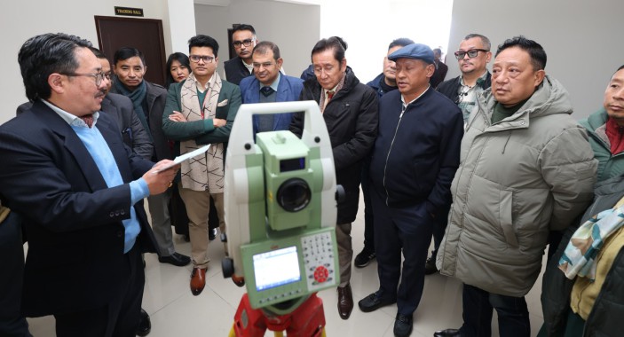
Survey of India director Uday
Prasad presented the technical features of the NAKSHA project. He discussed the
implementation of appropriate equipment and announced the selection of Garuda
UAV as the vendor responsible for carrying out the project's work.
NAKSHA State Nodal Officer Hem
Kumar Chettri provided an overview of the NAKSHA Project. He explained that the
initiative is a pilot project under the Digital India Land Record Modernization
Programme (DILRMP), which has been operational since September 2024. NAKSHA,
which stands for National Geospatial Knowledge-based Land Survey of Urban
Habitation, is an initiative launched by the Department of Land Resources,
Government of India.
The primary objective of NAKSHA
is to create and update land records in urban areas, thereby ensuring accurate
and reliable documentation of land ownership. The project is designed to
empower citizens, enhance living conditions, improve urban planning, and
mitigate land disputes.
The project will encompass a
survey of 19.02 square kilometers within the Gangtok Municipal Corporation
area, conducted in collaboration with officials from the Land Revenue
Department, the Urban Development Department, and the Gangtok Municipal
Corporation.
In conclusion, he urged the
councillors to provide their support in facilitating surveys within their
respective wards.
Earlier, a video on the NAKSHA
project was screened along with a video message by Shivraj Singh Chouhan, Union
Minister of Rural Development and Agriculture and Farmers Welfare.
The programme also featured a
session where the survey instruments were demonstrated to the guests.