


Thursday, Sep 03, 2026 10:15 [IST]
Last Update: Wednesday, Sep 02, 2026 17:16 [IST]


Retention structure proposed to slow future GLOFs from Lhonak watershed; DPR being prepared for submission to Jal Shakti Ministry
GANGTOK, : The Sikkim government is exploring the possibility of constructing
a large-scale flood retention structure at Dolma Sampa, a naturally widened and
relatively flat stretch of the Lhonak Valley, to slow down glacial lake
outburst flood (GLOF) waters and reduce the impact of future disasters in North
Sikkim.
The
proposed site near Muguthang, located about 24 km downstream of South Lhonak
Lake, has emerged as a potential flood mitigation location after scientific
investigations found that the devastating October 2023 GLOF naturally slowed
down at Dolma Sampa, where the otherwise narrow Lhonak Valley opens into a
broad flat terrain. The Department of Science & Technology (DST) is
pursuing the proposal in collaboration with the Central Water Commission (CWC)
under the Ministry of Jal Shakti.
DST
principal secretary Dr Sandeep Tambe, secretary-cum-principal director Dhiren
Shrestha and other officials shared details of the proposed hazard mitigation
measures for the Lhonak Lake cluster.
According
to DST officials, field investigations after the October 2023 South Lhonak GLOF
revealed that the floodwaters, expected to race downstream at high speed, lost
momentum after reaching Dolma Sampa. The wider terrain allowed large quantities
of boulders, sediment and debris to settle before the waters continued
downstream.
“During
our field survey we found that when the GLOF came, the flood actually slowed
down. The GLOF should have come down at great speed, but surprisingly this GLOF
slowed down at Dolma Sampa. It is a location in Lhonak Valley just near
Muguthang, and is called Dolma Sampa, which is 24 km below Lhonak Lake,” Dr
Tambe said.
The
Lhonak Valley remains extremely narrow through most of its course. However, at
Dolma Sampa, the valley expands to nearly one kilometre in width for almost
three kilometres, creating a relatively flat area of around 300 hectares.
“When
the GLOF reached Dolma Sampa with great speed, it spread across the flat area
and slowed down, and the accompanying boulders and debris got deposited there,”
he said.
The
department is now examining whether these natural characteristics can be
strengthened through structural intervention to create a large-scale retention
structure capable of delaying and reducing peak floodwaters before they travel
further downstream.
“So
we are looking at this natural solution possibility given by nature and
exploring what we can do to further slow down the GLOF and halt it at Dolma
Sampa itself,” Dr Tambe said.
Officials
stressed that the proposal remains at the conceptual and feasibility-study
stage, and no final decision has been taken on constructing any structure.
Further
studies, they said, will determine whether such an intervention is technically
feasible and whether it could inadvertently worsen flood conditions instead of
mitigating them.
The
Central Water Commission accompanied the State government's scientific
expedition to the Lhonak region last month and carried out detailed studies of
the proposed site.
Some
further studies are needed and the concept is under development phase, Dr Tambe
said.
The
CWC is preparing a Detailed Project Report (DPR) in collaboration with the DST,
which will later be submitted to the Ministry of Jal Shakti for consideration.
According
to the department, the proposed intervention could potentially provide
protection against GLOF events originating from the major glacial lakes in the
upper Lhonak watershed, including South Lhonak, North Lhonak and Changsang
lakes.
DST
officials said that if the proposal proves feasible and is successfully
implemented, it could serve as a single-point mitigation mechanism for a large
number of glacial lakes across the upper watershed.
“If
this proposal becomes successful, we will be catering to above 100 lakes at a
single time. We are trying to have a retention structure at the Dolma Sampa
watershed area and not at the lake level,” officials said, adding that such an
approach had not been attempted elsewhere and could become a pioneering
initiative by Sikkim.
The
proposal has emerged from a series of scientific investigations carried out by
the DST with State departments and Central agencies after the October 2023
South Lhonak GLOF.
A
multi-disciplinary team found significant differences in the way floodwaters
behaved across the river valley. While narrow sections experienced severe
erosion, wider sections witnessed substantial deposition of sediment, boulders
and other debris.
The
findings reinforced the importance of naturally widened stretches such as the
three-km-long and one-km-wide Dolma Sampa area in slowing floodwaters and
reducing their destructive force.
The
proposed intervention forms part of the State government's wider effort to
assess and reduce the growing risks posed by high-altitude glacial lakes in
Sikkim.
The
National Disaster Management Authority (NDMA) has identified 189
high-vulnerability glacial lakes across the Indian Himalayas, including 40
high-hazard glacial lakes in Sikkim. Of these 40 in Sikkim, 16 have been placed
in the highest-risk category.
Since
August 2024, the Department of Science & Technology, in coordination with
State departments and Central agencies, has studied 13 of these 16 highly
vulnerable lakes, most of them in North Sikkim.
All
these lakes lie at elevations above 17,000 feet and are extremely difficult to
access, with expeditions requiring extensive preparation comparable to
mountaineering missions.
The
latest multi-disciplinary expedition involving scientists, engineers and
geologists was conducted from July 23 to August 8 this year.
Based
on these field studies, the DST has prepared mitigation proposals for three
major high-hazard glacial lake clusters in Sikkim.
The
Lhonak Lake cluster, comprising South Lhonak, North Lhonak and Changsang lakes,
has been identified as one of the State's three major high-hazard glacial lake
complexes, alongside the Shako Chu and Gurudongmar complexes.
The
focus on the Lhonak cluster follows the catastrophic October 2023 GLOF, which
demonstrated the scale of destruction that a sudden release of water from a
high-altitude glacial lake can inflict downstream.
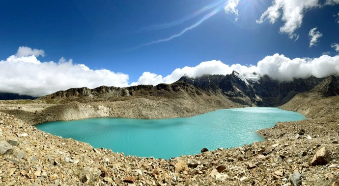
South
Lhonak Lake, situated above 17,000 feet in the extreme northern region of
Sikkim, was the source of the 2023 GLOF. The resulting flood travelled through
the Lhonak and Teesta river systems, causing widespread destruction downstream.
Reaching
the lake remains a major challenge for scientists and engineers. With no road
access, field teams must undertake a two-day trek, while the terrain has become
considerably more fragile since the 2023 disaster, making future expeditions
and mitigation work even more difficult.
Meanwhile,
the DST has continued monitoring the present condition of South Lhonak Lake.
According
to the department, the lake now measures about 2.70 km in length and covers
approximately 148 hectares. Before the October 2023 GLOF, it measured around
2.60 km in length and covered about 155 hectares.
Despite
changes in its shape and extent following the 2023 event, the department said
South Lhonak Lake is presently considered stable.
